Improvement Area Map
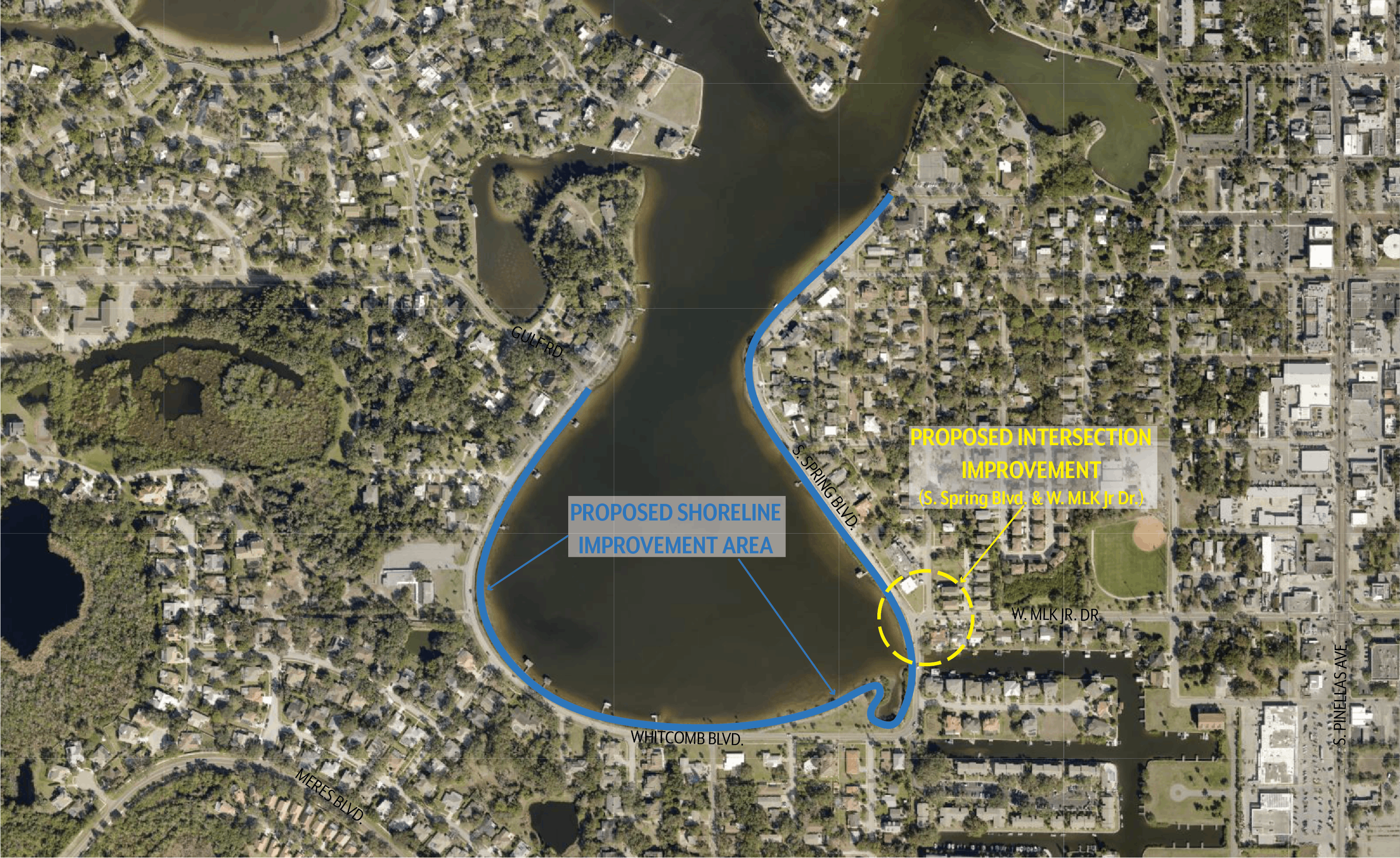
Map of Whitcomb Bayou showing the extent of the shoreline improvement project. The project limits extend from Craig Park to Gulf Road. The map also shows the location of the proposed intersection improvement at S. Spring Blvd. and W. MLK Jr. Dr.